Satellite News

Satellites are used for a large number of purposes. Common types include military (spy) and civilian Earth observation satellites, communication satellites, navigation satellites, weather satellites, and research satellites.

Thumbnail Recent Post

NASA Probe Sees Solar Wind Decline

The 33-year odyssey of NASA's Voyager 1 spacecraft has reached a distant point at the edge of our solar system where there is no outward motion of solar wind. Now hurtling toward interstellar space some 17.4 billion...

Super-Earth Atmosphere

A team of astronomers, including two NASA Sagan Fellows, has made the first characterizations of a super-Earth's atmosphere, by using a ground-based telescope...

Kepler Discovers

NASA's Kepler spacecraft has discovered the first confirmed planetary system with more than one planet crossing in front of, or transiting, the same star...

Pulverized Planet

Tight double-star systems might not be the best places for life to spring up, according to a new study using data from NASA's Spitzer Space Telescope....

Dark Asteroids

NASA is set to launch a sensitive new infrared telescope to seek out sneaky things in the night sky -- among them, dark asteroids that could pose a threat to Earth....

Archive for June 2009

The latest Geostationary Operational Environmental Satellite, GOES-O, soared into space on June 27 after a successful launch from Space Launch Complex 37 at the Cape Canaveral Air Force Station in Florida.

The GOES-O spacecraft lifted off at 6:51 p.m. EDT on a Delta IV rocket. The National Oceanic and Atmospheric Administrations GOES-O satellite will improve weather forecasting and monitor environmental events around the world. The satellite is the second to be launched in the GOES N series of geostationary environmental weather satellites.

All indications are that GOES-O is in a normal orbit, with all spacecraft systems functioning properly, stated Andre Dress, GOES deputy project manager at NASAs Goddard Space Flight Center in Greenbelt, Md. We are proud of our support teams and pleased with the performance of the Delta IV launch vehicle.

Approximately 4 hours and 21 minutes after launch, the spacecraft separated from the launch vehicle. The Universal Space Network Western Australia tracking site in Dongara monitored the spacecraft separation.

On July 7, GOES-O will be placed in its final orbit and renamed GOES-14. Approximately 24 days after launch, Boeing Space and Intelligence Systems will turn engineering control over to NASA. About five months later, NASA will transfer operational control of GOES-14 to NOAA. The satellite will be checked out, stored in orbit and available for activation should one of the operational GOES satellites degrade or exhaust its fuel.

NASA contracted with Boeing to build and launch the GOES-O spacecraft. NASAs Launch Services Program at NASAs Kennedy Space Center in Florida supported the launch in an advisory role. NOAA manages the GOES program, establishes requirements, provides all funding and distributes environmental satellite data for the United States. Goddard procures and manages the design, development and launch of the satellites for NOAA on a cost-reimbursable basis.

For more information about the GOES-O mission and program, visit:

The crew of the International Space Station (ISS) is about to get a new eye-pod. The Tranquility node headed for the space station early in 2010 will feature a viewing dome unlike any other window ever flown in space. The dome, called the Cupola, is literally studded with windows for observing Earth, space, and the marvelous expanse of the ISS itself.

The Cupola, named after the raised observation deck on a railroad caboose, is designed as an observation platform for operations outside the station--e.g., robotics, spacewalks, and docking spacecraft. Computer workstations inside the dome will give astronauts full control over the space station's robotic arm and dexterous manipulator, while the windows offer unparalleled views of these devices in action.

It's also a place where astronauts can unwind.

Crews tell us that Earth gazing is important to them, says Julie Robinson, the ISS Program Scientist at NASA's Johnson Space Center. The astronauts work hard up there and are away from their families for a long time. Observing the Earth and the stars helps relax and inspire them.

Until now, space station astronauts have been confined to looking out small portholes or at best the 20-inch window in the US Destiny Laboratory. The Cupola will dramatically expand their view.


The Cupola's 80-cm diameter circular top window is the largest window ever built for space, says Robinson. Rather than peering through a little porthole, the Cupola will allow a stunning look at the cosmos and unprecedented panoramic views of Earth. Astronauts will share these views with the world through photographs taken through the windows and posted online.

This could lead to scientific discoveries:

By photographing oblique views with different sun angles, the astronauts can use the Cupola to give scientists a view of the Earth that is not available from satellites, she adds. Astronaut photographs of Earth have been used to understand Earth processes such as melting of icebergs, noctilucent clouds, dust storms, and the structure of hurricane eyes.

It seems fitting that the space station is getting the Cupola around the time of the 40th anniversary of the Apollo program. Apollo astronauts, like the space station crew, cherished the experience of gazing back at the planet they left behind. Apollo 14 moonwalker Ed Mitchell had this to say:

Suddenly, from behind the rim of the moon, in long, slow-motion moments of immense majesty, there emerges a sparkling blue and white jewel, a light, delicate sky-blue sphere laced with slowly swirling veils of white, rising gradually like a small pearl in a thick sea of black mystery. It takes more than a moment to fully realize this is Earth . . . home.

From the Cupola, it's going to look better than ever.

On the eve of the 40th anniversary of the historic first moon landing, NASA is seeking ideas from the public, academia, and industry about how to analyze and catalog notes from spaceflight pioneer Wernher von Braun into an electronic, searchable database or other system.

Von Braun was the first director of NASA's Marshall Space Flight Center in Huntsville, Ala., and a key figure in the development of the Saturn V rocket and NASA's Apollo program. NASA has a full collection of Weekly Notes von Braun wrote during the 1960s and 1970s. These notes were used to track programmatic and institutional issues at Marshall, and are considered by many historians to be a valuable source of data.

NASA has issued a request for information and is looking for concepts that will provide an innovative resource for agency engineers and scientists, as well as researchers in academia and industry.

For additional information and to view the request for information, visit:


For more a complete biography of von Braun, visit:


NASA is planning several activities and events for the 40th anniversary of the first moon landing on July 20. The events will celebrate the Apollo Program, its accomplishments, and the benefits to our lives today.

For more information about NASA's Apollo 40th Anniversary activities, visit:

University of Chicago researchers recently showed that dry granular materials such as sands, seeds and grains have properties similar to liquid, forming water-like droplets when poured from a given source. The finding could be important to a wide range of industries that use fluidized dry particles for oil refining, plastics manufacturing and pharmaceutical production.

Researchers previously thought dry particles lacked sufficient surface tension to form droplets like ordinary liquids. But, in a first-time accomplishment, physicists from the Materials Research Science and Engineering Center at the University of Chicago, led by Professor Heinrich M. Jaeger, used high-speed photography to measure minute levels of surface tension and detect droplet formation in flows of dry granular materials.

The science journal Nature reports the finding in its June 25 issue. The materials research center at the University of Chicago is supported by the National Science Foundation.

Until recently, studies of so-called free falling granular streams tracked shape changes in flows of dry materials, but were unable to observe the full evolution of the forming droplets or the clustering mechanisms involved.

Previous studies of granular streams were able to detect clustering by performing experiments in vacuum and were able to establish that the clustering was not caused by the drag from the ambient air, said Jaeger. However, the cause of the clustering remained a mystery.

But in this new experiment, researchers measured nanoscale forces that cause droplet formation using a special co-moving apparatus devised for a high-speed, $80,000 camera that captures images much like a skydiver might photograph a fellow jumper in free fall.

They observed falling 100-micrometer-diameter glass beads, or streaming sand, and found that forces as much as 100,000 times smaller than those that produce surface tension in ordinary liquids could cause droplet formation in granular streams and cause these dry streams to behave like an ultra-low-surface-tension liquid.

John Royer, the graduate student in physics at the University of Chicago, who developed the apparatus, and his colleagues also directly measured grain-to-grain interactions with an atomic force microscope.

At first we thought grain-grain interactions would be far too weak to influence the granular stream, said Royer. The atomic force microscopy surprised us by demonstrating that small changes in these interactions could have a large impact on the break up of the stream, conclusively showing that these interactions were actually controlling the droplet formation.

Researchers say understanding how dry materials coalesce could create greater efficiencies in their transportation and manipulation. The pharmaceutical production of pills, for example, could benefit by pouring equal amounts of a drug into a capsule every time while greatly reducing waste.

Estimates show that we waste 60 percent of the capacity of many of our industrial plants due to problems related to the transport of these materials, said Jaeger. Hence even a small improvement in our understanding of how granular media behave should have a profound impact for industry.

The researchers write in their report that these experimental results open up new territory for which there currently is no theoretical framework.

Our experiments ask two questions for which currently there is no established answer said Jaeger. Both questions are about how a liquid breaks apart. How does the break-up proceed in the ultra-low surface-tension limit and what happens in the ultra-low temperature limit when particles cease to move relative to each other?

It is quite remarkable that a granular stream consisting of macroscopic particles provides a model system to explore it.

For the first time, scientists working on NASA's Cassini mission have detected sodium salts in ice grains of Saturn's outermost ring. Detecting salty ice indicates that Saturn's moon Enceladus, which primarily replenishes the ring with material from discharging jets, could harbor a reservoir of liquid water -- perhaps an ocean -- beneath its surface.

Cassini discovered the water-ice jets in 2005 on Enceladus. These jets expel tiny ice grains and vapor, some of which escape the moon's gravity and form Saturn's outermost ring. Cassini's cosmic dust analyzer has examined the composition of those grains and found salt within them.

"We believe that the salty minerals deep inside Enceladus washed out from rock at the bottom of a liquid layer," said Frank Postberg, Cassini scientist for the cosmic dust analyzer at the Max Planck Institute for Nuclear Physics in Heidelberg, Germany. Postberg is lead author of a study that appears in the June 25 issue of the journal Nature.

Scientists on Cassini's cosmic dust detector team conclude that liquid water must be present because it is the only way to dissolve the significant amounts of minerals that would account for the levels of salt detected. The process of sublimation, the mechanism by which vapor is released directly from solid ice in the crust, cannot account for the presence of salt.

"Potential plume sources on Enceladus are an active area of research with evidence continuing to converge on a possible salt water ocean," said Linda Spilker, Cassini deputy project scientist at NASA's Jet Propulsion Laboratory in Pasadena, Calif. "Our next opportunity to gather data on Enceladus will come during two flybys in November."

The makeup of the outermost ring grains, determined when thousands of high-speed particle hits were registered by Cassini, provides indirect information about the composition of the plume material and what is inside Enceladus. The outermost ring particles are almost pure water ice, but nearly every time the dust analyzer has checked for the composition, it has found at least some sodium within the particles.

"Our measurements imply that besides table salt, the grains also contain carbonates like soda. Both components are in concentrations that match the predicted composition of an Enceladus ocean," Postberg said. "The carbonates also provide a slightly alkaline pH value. If the liquid source is an ocean, it could provide a suitable environment on Enceladus for the formation of life precursors when coupled with the heat measured near the moon's south pole and the organic compounds found within the plumes."

However, in another study published in Nature, researchers doing ground-based observations did not see sodium, an important salt component. That team notes that the amount of sodium being expelled from Enceladus is actually less than observed around many other planetary bodies. These scientists were looking for sodium in the plume vapor and could not see it in the expelled ice grains. They argue that if the plume vapor does come from ocean water the evaporation must happen slowly deep underground rather than as a violent geyser erupting into space.

"Finding salt in the plume gives evidence for liquid water below the surface," said Sascha Kempf, also a Cassini scientist for the cosmic dust analyzer from the Max Planck Institute for Nuclear Physics. "The lack of detection of sodium vapor in the plume gives hints about what the water reservoir might look like."

Determining the nature and origin of the plume material is a top priority for Cassini during its extended tour, called the Cassini Equinox Mission.

"The original picture of the plumes as violently erupting Yellowstone-like geysers is changing," said Postberg."They seem more like steady jets of vapor and ice fed by a large water reservoir. However, we cannot decide yet if the water is currently 'trapped' within huge pockets in Enceladus' thick ice crust or still connected to a large ocean in contact with the rocky core."

The Cassini-Huygens mission is a cooperative project of NASA, the European Space Agency and the Italian Space Agency. The Cassini cosmic dust analyzer was provided by the German Aerospace Center. The Cassini orbiter was designed, developed and assembled at JPL. JPL manages the mission for the Science Mission Directorate at NASA Headquarters in Washington.

After a four and a half day journey from the Earth, the Lunar Reconnaissance Orbiter, or LRO, has successfully entered orbit around the moon. Engineers at NASA's Goddard Space Flight Center in Greenbelt, Md., confirmed the spacecraft's lunar orbit insertion at 6:27 a.m. EDT Tuesday.

During transit to the moon, engineers performed a mid-course correction to get the spacecraft in the proper position to reach its lunar destination. Since the moon is always moving, the spacecraft shot for a target point ahead of the moon. When close to the moon, LRO used its rocket motor to slow down until the gravity of the moon caught the spacecraft in lunar orbit.

"Lunar orbit insertion is a crucial milestone for the mission," said Cathy Peddie, LRO deputy project manager at Goddard. "The LRO mission cannot begin until the moon captures us. Once we enter the moon's orbit, we can begin to buildup the dataset needed to understand in greater detail the lunar topography, features and resources. We are so proud to be a part of this exciting mission and NASA's planned return to the moon."

A series of four engine burns over the next four days will put the satellite into its commissioning phase orbit. During the commissioning phase each of its seven instruments is checked out and brought online. The commissioning phase will end approximately 60 days after launch, when LRO will use its engines to transition to its primary mission orbit.

For its primary mission, LRO will orbit above the moon at about 31 miles, or 50 kilometers, for one year. The spacecraft's instruments will help scientists compile high resolution, three-dimensional maps of the lunar surface and also survey it at many spectral wavelengths.

The satellite will explore the moon's deepest craters, examining permanently sunlit and shadowed regions, and provide understanding of the effects of lunar radiation on humans. LRO will return more data about the moon than any previous mission.

Two NASA spacecraft will reach major mission milestones early Tuesday morning as they approach the moon -- one will send back live streaming imagery via the Internet as it swings by the moon, the other will insert itself into lunar orbit to begin mapping the moon's surface.

After a four and a half day journey to the moon, NASA's Lunar Reconnaissance Orbiter, or LRO, will be captured by the moon's gravity and prepare for the commissioning phase of its mission on June 23. NASA TV live coverage of LRO's orbit insertion begins at 5:30 a.m. EDT Tuesday, with the actual engine burn to begin orbit insertion starting at 5:47 a.m.

In addition to animation and footage of LRO, live interviews will be broadcast from NASA's Goddard Space Flight Center in Greenbelt, Md., with Cathy Peddie, LRO deputy project manager at Goddard; Jim Garvin, Goddard chief scientist; Laurie Leshin, Goddard deputy director for Science and Technology; Mike Wargo, NASA's chief lunar scientist in the Exploration Systems Mission Directorate at NASA Headquarters in Washington; Rich Vondrak, LRO project scientist at Goddard; and Craig Tooley, LRO project manager at Goddard.

At 8:20 a.m. Tuesday, the Science Operations Center at NASA's Ames Research Center in Moffett Field, Calif., will stream live telemetry-based spacecraft animation and the visible camera images from the Lunar Crater Observation and Sensing Satellite, or LCROSS, spacecraft as it swings by the moon before entering into a looping polar Earth orbit. Live video streaming via the Internet will last approximately one hour.

The live video streams of the LCROSS swingby will be available at:


The LCROSS swingby starts near the lunar south pole and continues north along the far side of the moon. The maneuver will put the LCROSS spacecraft and its spent second stage Centaur rocket in the correct flight path for the October impact near the lunar south pole. The swingby also will give the mission operations team the opportunity to practice the small trajectory correction maneuvers needed to target the permanently shadowed crater that will be selected by the LCROSS science team.

During the swingby, the science team will make measurements of the moon's surface and the lunar horizon to calibrate the spacecraft's cameras and spectrometers. The LCROSS visible spectrometer will make the first near-ultraviolet survey of the selected locations on the far-side of the moon giving scientists a unique look at the concentration of minerals and elements in the lunar soil.

LCROSS and its attached Centaur upper stage rocket separately will collide with the moon the morning of Oct. 9, 2009, creating a pair of debris plumes that will be analyzed for the presence of water ice or water vapor, hydrocarbons and hydrated materials.For more information about NASA's LCROSS and LRO missions, visit:


and

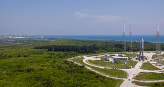
NASA'S LRONASA's Lunar Reconnaissance Orbiter, or LRO, and the Lunar Crater Observation and Sensing Satellite, or LCROSS, rolled aboard their Atlas V rocket to the launch pad at Cape Canaveral Air Force Station in Florida Wednesday morning in preparation for launch on Thursday. The spacecraft left its processing facility at 10:02 EDT and arrived at the pad about 35 minutes later.

The spacecraft are scheduled to lift off together on Thursday, June 18, with three attempts possible at 5:12 p.m., 5:22 p.m. and 5:32 p.m. If launch slips to Friday, June 19, the launch opportunities would be 6:41 p.m., 6:51 p.m. and 7:01 p.m.

LRO is scheduled for a one-year exploration mission at a polar orbit of about 31 miles, or 50 kilometers, the closest any spacecraft has orbited the moon. Its primary objective is to conduct investigations to prepare for future explorations of the moon. LCROSS will search for water ice on the moon by sending the spent upper-stage Centaur rocket to impact part of a polar crater in permanent shadows. LCROSS will fly into the plume of dust left by the impact and measure the properties before also colliding with the lunar surface.

NASA TV coverage of the launch will begin at 2 p.m. June 18. For information about NASA TV streaming video, downlink and schedule information, visit:


For more information about the LRO and LCROSS missions, visit:

The Geostationary Operational Environmental Satellite-O, or GOES-O, is scheduled for a liftoff on Friday, June 26, from Cape Canaveral Air Force Station in Florida. The one-hour launch window extends from 6:14 to 7:14 p.m. EDT. GOES-O is the second of three in the current series of geostationary weather and environmental satellites.

NASA will provide television, Internet and photo coverage of the launch starting with a prelaunch news conference at 1 p.m. on Thursday, June 25, at NASA's Kennedy Space Center news center.

Participants in the June 25 prelaunch news conference will be:
- Gary Davis, director, Office of Systems Development, NOAA Satellite and Information Service, Suitland, Md.
- Andre Dress, GOES-O deputy project manager, Goddard Space Flight Center
- Bart Hagemeyer, meteorologist in charge, NOAA National Weather Service forecast office, Melbourne, Fla.
- Ken Heinly, director, launch products and services, Boeing Launch Services, Huntington Beach, Calif.
- Charlie Maloney, GOES-O program manager, Boeing Space and Intelligence Systems, Seal Beach, Calif.
- Joel Tumbiolo, Delta IV launch weather officer, 45th Weather Squadron, Cape Canaveral Air Force Station - Kris Walsh, Commercial Programs manager, United Launch Alliance, Houston

NASA's Goddard Space Flight Center in Greenbelt, Md., was responsible for designing and developing the GOES-O spacecraft and its instruments for NOAA. Boeing Space and Intelligence Systems built GOES-O for NASA. It will be launched into orbit for NASA aboard a United Launch Alliance Delta IV rocket procured by Boeing Launch Services.

NASA Television will carry the prelaunch news conference on the public channel. On launch day, June 26, NASA TV countdown coverage will begin on the media channel at 4 p.m. and will conclude 30 minutes after liftoff. For NASA TV downlink information, schedules and links to streaming video, visit:


Audio only of the prelaunch news conference and the launch coverage will be carried on the NASA "V" circuits which may be accessed by dialing 321-867-1220, -1240, -1260 and -7135. On launch day, "Mission Audio," the launch conductor's countdown activities without NASA TV launch commentary, will be carried on 321-867-7135 starting at noon. Launch also will be available on local amateur VHF radio frequency 146.940 MHz heard within Brevard County.

Prelaunch and launch day coverage of the GOES-O mission will be available on the NASA Web site at:


Live countdown coverage on NASA's launch blog begins at 4 p.m. on June 26. Coverage features real-time updates of countdown milestones, as well as streaming video and podcast of launch. For more information, visit


For further information about GOES-O's launch coverage, contact the Kennedy Space Center news center at 321-867-2468.

The POES satellite system offers the advantage of daily global coverage, by making nearly polar orbits roughly 14.1 times daily. Since the number of orbits per day is not an integer the sub orbital tracks do not repeat on a daily basis, although the local solar time of each satellite's passage is essentially unchanged for any latitude. Currently in orbit we have a morning and afternoon satellite, which provide global coverage four times daily. The POES system includes the Advanced Very High Resolution Radiometer (AVHRR) and the Tiros Operational Vertical Sounder (TOVS).

Because of the polar orbiting nature of the POES series satellites, these satellites are able to collect global data on a daily basis for a variety of land, ocean, and atmospheric applications. Data from the POES series supports a broad range of environmental monitoring applications including weather analysis and forecasting, climate research and prediction, global sea surface temperature measurements, atmospheric soundings of temperature and humidity, ocean dynamics research, volcanic eruption monitoring, forest fire detection, global vegetation analysis, search and rescue, and many other applications.

On April 1, 2000, the National Oceanic and Atmospheric Administration celebrated the 40th anniversary of the launch of the world's first weather satellite. With today's advanced technology, and with images of clouds shown daily on television weather forecasts, it may be difficult to remember the days when there were no weather satellites.

Today, the nation's environmental satellites are operated by NOAA's National Environmental Satellite, Data, and Information Service in Suitland, Maryland. NOAA's operational environmental satellite system is composed of two types of satellites: geostationary operational environmental satellites (GOES) for national, regional, short-range warning and "now-casting," and polar-orbiting environmental satellites (POES) for global, long-term forecasting and environmental monitoring. Both types of satellites are necessary for providing a complete global weather monitoring system. In addition, NOAA operates satellites in the Defense Meteorological Satellite Program (DMSP), which are also polar-orbiting satellites. NESDIS also manages the processing and distribution of the millions of bits of data and images the satellites produce each day.

2009 is being celebrated worldwide as the "International Year of Astronomy (IYA)". Indian Space Research Organisation (ISRO) is one of the organisational associates of IYA. The details of the national program on IYA activities in India is available at Inter University Centre for Astronomy & Astrophysics (IUCAA).

The Indian space program has always encouraged the study of the universe using space as a platform. The research work in the areas of cosmic rays, infrared, X-rays, gamma ray and solar physics were initially carried out using high altitude balloons and rockets. Today many of these studies are carried out using satellite experiments. Since 90s, opportunities to fly space science experiments have increased and numerous science payloads have been deployed as piggyback systems on several satellites from India. These include:

* SROSS-series GRB experiments.
* IXAE on IRS-P3.
* SOXS on GSAT-2.


More recently, ISRO has undertaken development of dedicated satellites for space sciences. The first of these CHANDRAYAAN-1 was launched on October 22, 2008, marking India's entry into solar system exploration studies. CHANDRAYAAN-1 will soon be followed by a dedicated multi-wavelength astronomy satellite ASTROSAT, slated for 2010 launch.